STORM ISHA: Donegal under rare red alert with upgraded amber warning for Derry & NI as outages, huge waves and treacherous travel conditions likely
and live on Freeview channel 276
A rare Status Red wind warning for Donegal as well as Counties Mayo and Galway has been issued by Met Éireann, while the Met Office has placed all six counties in the north under amber alert.
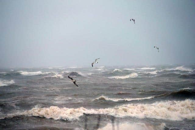
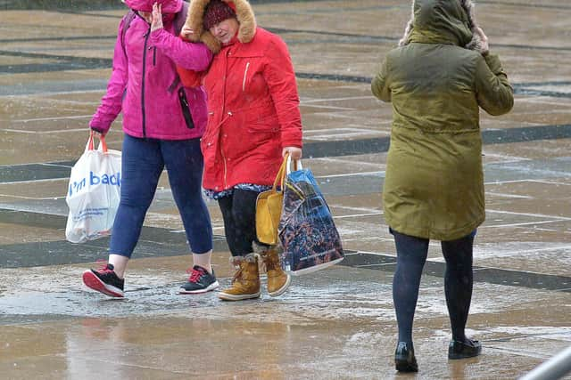
People in Donegal have been advised that Storm Isha “will bring extremely strong and gusty southwest winds with severe and destructive gusts, particularly in coastal and exposed areas”.In terms of the impact this could have locally, Met Éireann cautioned that people could encounter dangerous coastal conditions with high waves, treacherous travelling conditions and the risk of significant and widespread power outages.
Advertisement
Hide AdAdvertisement
Hide AdThe red alert for Donegal comes into effect from 9pm tonight, Sunday and continues through until 1am on Monday.

An amber wind warning brackets the red warning for Donegal, Mayo and Galway, commencing at the earlier time of 4pm today and lasting through to 3am tomorrow.
The Met Office in the north meanwhile has also urged people to expect disruption as it issued an upgraded Amber Wind Warning for Derry, Tyrone, Antrim, Armagh, Down and Fermanagh.
It is predicting that a spell of “very strong, perhaps damaging, winds associated with Storm Isha is likely to bring disruption to transport and infrastructure”.
Advertisement
Hide AdAdvertisement
Hide AdThe Met Office amber warning is valid from 6pm on Sunday to 6am on Monday.
In terms of what to expect, the Met Office statedb that amage to buildings and homes is possible, “with roofs blown off and power lines brought down”.
It adds: “Roads, bridges and railway lines may close, with delays and cancellations to bus, train, ferry services and flights.
“Power cuts could occur and affect other services, such as mobile phone coverage.
"Flying debris could result in a danger to life.
Advertisement
Hide AdAdvertisement
Hide Ad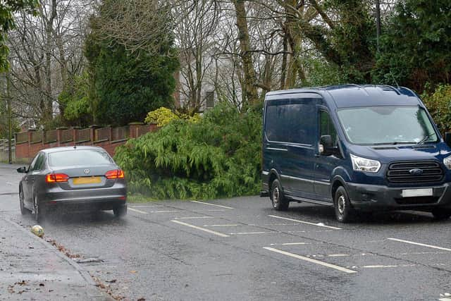
"There is potential for large waves and beach material being thrown onto sea fronts, coastal roads and properties.”
The Met Office advises that when there is a wind warning in place, people should check for loose items outside your home and plan how you could secure them in high winds, such as bins, plant pots, garden furnitur e and trampolines.
Those who absolutely have to travel should check conditions and pack essentials in their car such as warm clothing, food, drink, blanket, torch, and also a fully charged mobile phone with an in-car charger or battery pack.
“Driving in these conditions can be dangerous, for yourself and other road users. If you must drive, you can do this more safely by: Driving slowly to minimise the impact of wind gusts; Be aware of high sided vehicles/caravans on more exposed roads; Be cautious overtaking high sided vehicles/caravans; Make sure you hold the steering wheel firmly; Give cyclists, motorcyclists, lorries and buses more room than usual.”
Advertisement
Hide AdAdvertisement
Hide AdThe Met Office advises those who live or work near coastal areas: “Check the forecasts and tides in your local area here; Beware of large waves, even from the shore large breaking waves can sweep you off your feet and out to sea; Take care if walking near cliffs – know your route and keep dogs on a lead; In an emergency 999 (UK) or 112 (Ireland) and ask for the Coastguard.”