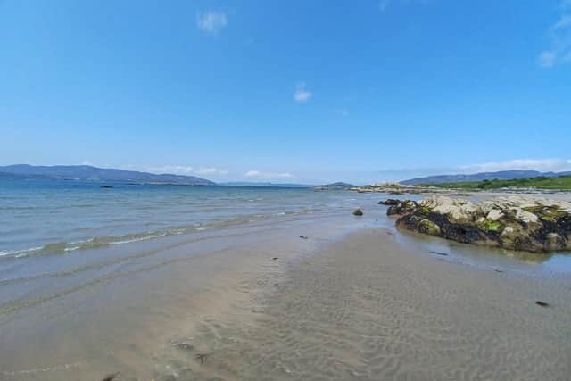
Derry and Donegal will continue to bask in warm summer sunshine as heatwave continues
and live on Freeview channel 276
Meteorologists are forecasting temperatures in the high teens and early 20s right up until and including the weekend at least though there is a potential for some cloudy spells particularly towards the end of the week.
The Met Office is predicting that Tuesday will be another dry, bright and warm day in Derry once the overnight mist clears with a maximum temperature of 23 °C.
Advertisement
Hide AdAdvertisement
Hide AdIt is expected to remain dry, warm and settled with some good spells of sunshine especially across the west, until Friday.


Met Éireann is forecasting that high atmospheric pressure will keep things generally dry and warm with plenty of sunshine until the weekend when it will stay warm with temperatures in the high teens or low twenties.
There is uncertainty in the forecast for the weekend as yet but there is a chance that some showers will move across the country from the south as an area of low pressure tracks eastward from the Atlantic, according to Met Éireann.
This week will again by characterised by large fluctuations in temperature with the mercury dipping by about 10 degrees in the evenings from day time highs ranging between 19 and 23 degrees throughout the course of the week.
Reservoir and quarry warning
Advertisement
Hide AdAdvertisement
Hide AdWith the good weather continuing the public are being warned not to swim in reservoirs, rivers or disused quarries due to the the dangers of drowning, hidden hazards and cold water shock.
A government advisory issued through the NI Direct website notes: "The dangers of water include:
- Very cold temperatures - the water can be colder than expected, even in warm weather.
- Hidden currents - there can be strong underwater currents, which can trouble even the most confident of swimmers.
- Reservoirs are often very deep - it is difficult to estimate depth and they can be deeper than people expect.
- There may be hidden debris or underwater hazards which can cause injury, including weeds and plants which can entangle people under the water.
- If it’s polluted it could make you ill
- It can be very difficult to get out (especially steep slimy banks) there are no lifeguards on duty.
- The remoteness of some of these places can also hamper and delay rescue attempts."

Gorse and forest fire warning
The Irish Department of Agriculture, Food and Marine, meanwhile, has issued a ‘condition orange - high fire risk’ for forest fires that will remain live until 6pm on Tuesday.
It states: "Arising from current weather patterns a high fire risk is deemed to exist in all areas where hazardous fuels such as dead grasses and shrub fuels such as heather and gorse exist.
Advertisement
Hide AdAdvertisement
Hide Ad"Westerly high-pressure dominated weather will induce settled weather and higher temperatures across Ireland in coming days.
"While some areas may receive isolated rain showers during this time, most areas can be expected to see dry weather, higher temperatures and strongly elevated fire risks in areas with fire-prone vegetation types."
Hay fever
Hay fever sufferers should note that the grass pollen risk will rise to high as a result of the warm, dry and sunny weather and as more and more grasses come into flower, the risk will continue to increase, with the peak period arriving in the middle two weeks of June.
Weed pollen will continue to increase, currently with plantain, dock and nettle in flower.
Advertisement
Hide AdAdvertisement
Hide AdCladosporium, a fungal spore, is also on the rise with a high risk during the warmest, driest weather.
Heatwave follows warm and dry May
The ongoing heatwave follows a warm and dry May when high pressure dominated for most of the month, especially the second half.
Met Éireann's climate statement for the May indicates mean temperatures for the month 'ranged from 11.7 °C (1.4 °C above its Long-Term Average) at Malin Head, Co Donegal to 13.5 °C (1.5 °C above its LTA) at Shannon Airport, Co. Clare'.
There was also above average sunshine levels in the north west.
Advertisement
Hide AdAdvertisement
Hide Ad"Monthly sunshine totals ranged from 170.1 hours (no LTA comparison) at Malin Head, Co. Donegal to 226.3 hours (no LTA comparison) at Johnstown Castle, Co Wexford.
"The highest number of daily sunshine hours recorded this month was 16.0 hours at Malin Head, Co. Donegal on Tuesday, May 30.
"The number of dull days ranged from 1 day at both Gurteen, Co Tipperary and Casement Aerodrome, Co. Dublin to 4 days at both Malin Head, Co. Donegal and Valentia Observatory, Co. Kerry," the climate statement shows.
Stormy Atlantic
While Derry and Donegal will continue to enjoy blue skies and sunshine other parts of the Atlantic area are experiencing a rather different picture.
Advertisement
Hide AdAdvertisement
Hide AdThe Agencia Estatal de Meteorología has warned of a tropical storm heading in the direction of the Canary Islands.
“An extensive storm located today, Monday, southwest of the Azores islands, with several systems frontal within it, will deepen and move closer to the Canary Islands over the next few days, leading to intense rains and winds in the archipelago during Tuesday, June 6 and Wednesday, June 7, mainly in the western islands.
“In reality, they are successive small lows in subtropical latitudes within the great storm, with its associated fronts and high moisture content, which will impact on the islands.
"One of these small storms will deepen especially, forming the squall Oscar, who will be the protagonist of this episode,” statement the Spanish meteorological service.