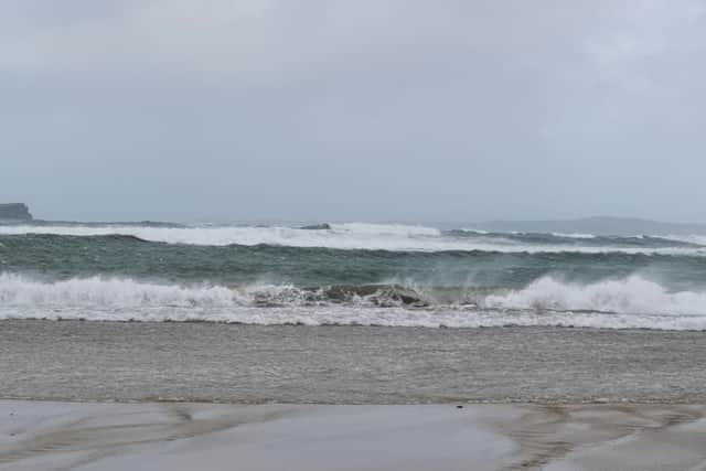
Watch as Storm Dudley whips up the waves in Ballyliffin, Donegal
This article contains affiliate links. We may earn a small commission on items purchased through this article, but that does not affect our editorial judgement.
and live on Freeview channel 276
An amber warning is in place for gale force winds and stormy coastlines as people are urged to take precautions.
This video taken in Ballyliffin in Donegal earlier today (Wednesday) shows the storm whipping the waves up into a frenzy.
Advertisement
Hide AdAdvertisement
Hide AdThe Met Office said strong winds will cross the north of Ireland this afternoon, before pushing eastward to northern England by evening.

“80-90 mph wind gusts are possible on exposed coasts and hills of Scotland with 60-70 mph possible further inland. The worst of the winds are expected to ease through Thursday morning,” The Met Office said.
The amber warning takes in Derry and part of Inishowen as well as the north coast of Ireland and Scotland “where the strongest and most disruptive winds are expected”, with the rest of Ireland and Britain and under a yellow warning.
Met Eireann meanwhile has concurred that today: “Westerly winds associated with Storm Dudley will reach mean speeds of 50 – 65km/h with damaging gusts of 80 – 110km/h, stronger on exposed coasts and on high ground.
Advertisement
Hide AdAdvertisement
Hide AdA combination of high tide and strong winds will lead to a possibility of flooding on Atlantic coasts. Occasional heavy rain will also bring a possibility of spot flooding.
The NI Weather & Flood Advisory Service has said the warning is valid from 3pm Wednesday to Thursday morning.
It advises:“The public should be aware of: Risk of Disruption to travel - Road, Rail, Air & Ferry services; Risk of Interruptions to power supplies; Downed trees, power lines & Damage possible to roof tiles and lose objects etc; Risk of large waves impacting coastal areas - Coastal flooding etc.
“The public are advised to: Take extra care if travelling; Stay away from downed trees & power lines; Take note of emergency contact numbers; Remove or tie down any loose objects in gardens; Avoid coastal areas such as beach & sea fronts, promenades and coastal roads due to risk to personal safety from large over topping waves and debris.”
Advertisement
Hide AdAdvertisement
Hide AdAnd then after a brief respite on Thursday, winds will gather strength once again as Storm Eunice arrives with the potential for heavy snowfall.
On this, Met Eireann said: Storm Eunice will track over Ireland on Thursday night and on Friday bringing very strong winds and falls of heavy rain, sleet and snow. Some disruption is likely along with a possibility of coastal and spot flooding. Warnings will be updated on Thursday morning.”