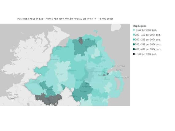
COVID-19 rate in BT47 and BT48 continues to fall but at a slowing pace


On Monday it was reported that between November 9 and November 15 the case rate in BT48, which covers the cityside of Derry, fell to 217.4 per 100,000 people with 132 cases registered during the week.
That was down from case rates of 283.2 per 100,000 a week ago, 398.5 per 100,000 a fortnight ago, 691.6 per 100,000 three weeks ago, and 1,155.9 per 100,000 four weeks ago.
Advertisement
Hide AdAdvertisement
Hide AdIn BT47, which covers the Waterside and the countryside on the east bank of the Foyle to Dungiven, there has been a similar decline albeit at a slower pace than previous weeks.
The rate has fallen to 216.4 per 100,000 people with 133 positive cases over the seven days. This fell from 275 per 100,000 last week, 364.5 per 100,000 a fortnight ago, 595.5 per 100,000 three weeks ago, and 997.4 per 100,000 four weeks ago.
Two dozen postal districts in the north are now recording higher rates than BT47 and BT48.
The BT52 district which covers Coleraine is now suffering the highest COVID-19 prevalence rate in the north.
Its rate of 682.1 is now three times higher than both BT47 and BT48.
Comment Guidelines
National World encourages reader discussion on our stories. User feedback, insights and back-and-forth exchanges add a rich layer of context to reporting. Please review our Community Guidelines before commenting.