
Record-breaking 2025 for wind and sunshine in Derry and Donegal as second warmest year shows impact of climate change
It was a recording-breaking 2025 for wind and, believe it or not, sunshine in Derry and Donegal, according to annual reports from meteorology services on both sides of the border.
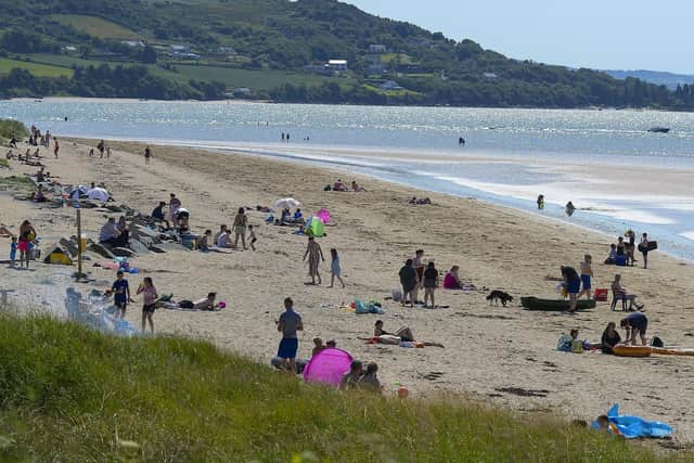
At weather station level, Magilligan recorded 301.3 hours of sunshine in May 2025, the highest monthly sunshine total ever recorded in the North for any month, the Met Office has reported.
The highest number of daily sunshine hours recorded in the 26 counties, meanwhile, was 15.7 hours fifteen miles away from Magilligan in Malin Head, Co Donegal on July 12, according to Met Éireann.
And Malin Head saw its highest monthly sunshine total for April on record (length 68 years).


It was an unusually dry 2025 in the North West with the ‘Sunny South East’ actually getting more rainfall than ourselves.
The percentage of annual rainfall values ranged from 86 per cent (983.2 mm) at Malin Head, Co Donegal to 124 per cent (1322.9 mm) at Johnstown Castle, Co Wexford (its second wettest year on record).
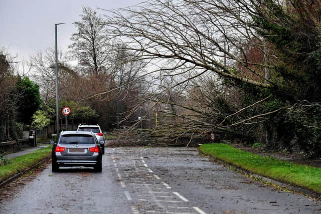
Very high wind speeds were reported during both Storm Éowyn last January and Storm Amy in October.
Mean wind speeds reached violent storm force 11 at Finner and Malin Head, Co Donegal on Friday, January 24, during Storm Éowyn and at Malin Head on Friday, October 3, during Storm Amy. And mean wind speeds reached hurricane force 12 at Malin Head during Storm Éowyn.
The Met Office noted that a gust of 92 miles per hour at Magilligan was the strongest October gust on record in the six counties.
It was the second warmest year on record in the 26 counties since 1900 with the last four years now the top four warmest years on record (2022-2025). The North recorded its second warmest year since 1884.
It was wetter than normal in the the south and drier than normal in the North.
Met Éireann report that provisional rainfall data suggests 2025 was the 15th wettest year since 1941, 104 per cent of the 1991-2020 Long-Term Average (LTA).
The Met Office says the North recorded 97 per cent of its average annual rainfall.
The average annual air temperature for Ireland in 2025 (using the Island of Ireland dataset*) was 11.14 °C, which is 1.59°C above the 1961-1990 long-term average (LTA) or 0.97°C above the most recent 1991-2020 LTA.
This makes 2025 the second warmest year on record, which is only slightly behind the warmest year in 2023 (11.21 °C) and only the second time with a mean over 11 °C.
Another marine heatwave earlier in 2025 and generally higher than average sea surface temperatures (SST) around our coasts and across the North Atlantic have contributed to higher than average mean temperatures and increased moisture content in the atmosphere over Ireland.
Meteorologists on both sides of the border say the warming trend is in line with what should be expected from human-induced climate change.
Met Éireann Climatologist Paul Moore said: “The warming trend is very clear with the last four years being the warmest four years on record in Ireland, since 1900. 2025 saw not only our warmest spring, but also our warmest summer on record, with high nighttime temperatures contributing to the summer record.
"We experienced five named storms in 2025, as well as a number of impactful rain events. The continued warming brings with it the increasing risk of severe weather events.”
Head of climate attribution at the Met Office, Dr. Mark McCarthy, said: “2025 was the warmest year on record for the UK, surpassing the previous record set in 2022, in a series dating back to 1884.
“We’re increasingly seeing UK temperatures break new ground in our changing climate, as demonstrated by a new highest UK mean temperature record just three years after the last record.
“This very warm year is in line with expected consequences of human-induced climate change. Although it doesn’t mean every year will be the warmest on record, it is clear from our weather observations and climate models that human-induced global warming is impacting the UK’s climate.”
The latest Irish climate change projections indicate further warming in the future.
This temperature change means the likelihood of extreme weather events occurring has increased. Irish rainfall patterns are expected to change, with an increase in both dry periods and heavy rainfall events.
Global sea levels continue to rise and as a result, storm surge and coastal flooding risk around Irish coasts is expected to increase along with ‘compound events’ involving a combination of heavy rainfall and high tides.
Climate change is adding fuel to storms due to warmer waters and more moisture in the atmosphere and studies show that storms we’ve experienced in the past (e.g. Ophelia) will become more powerful, larger, and more destructive in a warmer world.
Met Office Scientist Dr Emily Carlisle said: “While many will remember the long warm spring and summer of 2025, what has been noteworthy this year has been the consistent heat throughout the year, with every month except January and September warmer than average.
“In the six months from March to August, every month was at least 1°C above the 1991-2020 average. This resulted in the warmest spring and the warmest summer we have seen in this series.
“Meteorologically, the warmth has been driven largely by persistent high-pressure systems bringing prolonged dry, sunny conditions, alongside above-average sea temperatures around the UK. These factors have combined to keep temperatures consistently higher than normal for much of the year.”