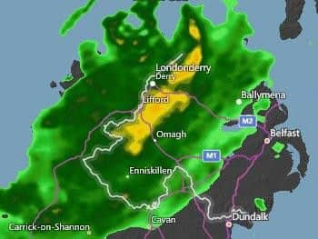
Storm Erik is about to drop a 'weather bomb' on Northern Ireland


Erik will bring with it very strong winds measuring at between 60mph an 70mph.
The Met Office has issued two weather warnings for Northern Ireland as a result.
Advertisement
Hide AdAdvertisement
Hide AdThe first weather warning is valid between 9:00am and 6:00pm on Friday.


The second weather warning becomes active at 12:15am on Saturday and remains valid until 3:00pm the same day.
Both these warnings apply to all of Northern Ireland.
What is a 'weather bomb'?
A 'weather bomb' is an unofficial term for a low pressure system whose central pressure falls 24 millibars in 24 hours in a process known as explosive cyclogenesis.
Rapid acceleration of air caused by the jet stream high up in the atmosphere can remove air from the column, reducing its weight so causing pressure to fall at sea level.
Advertisement
Hide AdAdvertisement
Hide AdThis in turn sucks in air which converges from surrounding regions resulting in faster and faster rotation of the circulation, in the same way that ice skaters spin faster by drawing their arms in.
The resulting winds peak over a period of a few hours and can be strong enough to bring down trees and cause structural damage.