Storm Barra: Red alert active for some parts of Ireland; wind, rain, snow warning for North West
and live on Freeview channel 276
There has already been snow in parts of County Donegal overnight with drivers urged to be careful as conditions on the roads may be very difficult this morning.
Gritters are currently understood to be operational across the north west.
Advertisement
Hide AdAdvertisement
Hide AdMeanwhile upgraded weather warnings have been issued for the south west of the country and the east coast with schools shut and people warned to avoid all but essential travel as Storm Barra makes landfall.
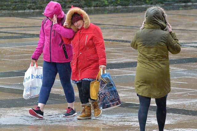

Cork, Kerry and Clare are on red alert while some other regions, namely Dublin, Louth, Wicklow and East Meath have been issued with a Status Orange alert.
Storm Barra, which was described yesterday as akin to a ‘weather bomb’ by one forecaster in Ireland, is set to hit the south west of Ireland first before moving in an upward trajectory with the worst of the weather for us here in the north west in Derry, Donegal and Tyrone expected later this afternoon and into this evening.
In its general warning for the whole of Ireland, valid from 8:00 am today, Tuesday, Met Éireann stated that Storm Barra will bring “widespread mean speeds of 50 to 65 km/h and gusts of 90 to 110 km/h with localised stronger winds likely.”
Advertisement
Hide AdAdvertisement
Hide Ad“Heavy rain will also bring risks of surface flooding and, due to a combination of high waves, storm surge and high tide, coastal flooding is expected. Disruption to power and travel are likely.”
In its forecast for today, Met Éireann elaborated: “Storm Barra will bring severe and damaging wind gusts today. The winds will be strongest on exposed coastal areas of Munster and Connacht. Gale to storm force southeast winds will veer west and later northwest in direction.
“Heavy rain will move northeastwards across the country during the morning followed by widespread squally showers. Falls of sleet and snow are likely in places, especially across the north and west during the morning then in the south at times later.
“Coastal flooding is expected along with travel disruption. As the eye of the storm passes over the centre of the country winds will fall light and variable for a time. Afternoon temperatures of 5 to 7 degrees.
Advertisement
Hide AdAdvertisement
Hide Ad“Tonight: The strong winds continue through Tuesday night. There will be frequent squally showers, some of sleet and snow with hail and isolated thunderstorms. Further damaging and possibly disruptive wind gusts are expected, especially in Atlantic coastal counties with gale to storm force west to northwest winds. A cold night with lowest temperatures of 1 to 4 degrees.”
The UK Met Office has advised people across the north to expect ‘strong winds and heavy rain bring a risk of some travel disruption and flooding’ as it’s yellow warning for the region comes into effect.
While the worst of the weather is expected elsewhere, the Met Office urged people that there is a slight risk of power cuts, a risk some roads and bridges could close and of damage to buildings, such as tiles blown from roofs.