
Yellow warning issued for Derry as storms Austen and Boelo to impact Ireland
A yellow warning has been issued for Derry this weekend with heavy rain and high winds expected to pummel the north west as storms Austen and Boelo make landfill in Ireland from Thursday evening through to Monday.
While there is potential for heavy showers, the north west is expected to escape the worst of Storm Austen with no warnings in place. However a Yellow wind alert has been issued for Derry during Storm Boelo at the weekend, while the Met Éireann is advising people to be mindful of any outdoor Halloween decorations in advance of the second storm.
Further south an Storm Austen Amber alert has been issued for today by Met Éireann for counties along the southern coast of Ireland and a yellow alert for other counties from the eastern coast across the midlands into County Clare.
A Small Craft alert for all coasts of Ireland has been issued however for today, Thursday, with “east to northeast winds veering northwesterly will reach force 6 or higher at times”. The warning is active from 3pm Thursday to 11pm on Saturday. There will be little respite however as Storm Boelo rolls in bringing another Met Éireann Status Yellow Marine Warning on Saturday morning through to midnight with “westerly winds will reach gale force 8 at times.”
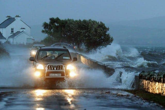

For Saturday, the UK Met Office has issued a Yellow warning for Derry and the rest of the North, stating that Storm Boelo will be bringing “a very windy spell this weekend with some disruption possible across parts of Northern Ireland”. The warning is in place for the north from 6pm Saturday to 3pm on Sunday.
“Strong westerly winds will spread across Northern Ireland during Saturday evening. Very windy conditions will persist overnight and into Sunday before gradually easing from the southwest during the afternoon. Gusts of 50-60 mph are likely widely with some coastal or exposed areas potentially seeing gusts of 65-75 mph. Strong winds will be combined with blustery heavy showers at times,” the Met Office states.
While no alerts for the north west have been issued as yet by Met Éireann for Storm Boelo, they concur that high winds are expected, with wind speeds at this stage forecast to reach 104km an hour in Carndonagh in the early hours of Sunday morning.
Commenting on the weekend ahead, a spokesperson for Met Éireann said: “Once Storm Austen clears on Friday, there will be a brief drier interlude. However, conditions will become very unsettled over the weekend.
"Another area of low pressure is forecast to track to the north of Ireland through Saturday and Sunday. This will bring a further spell of rain across the country with potential for windy conditions too. As this is the Bank Holiday weekend there will be many events taking place around the country, with Halloween decorations and temporary structures in place, so we would advise that people keep an eye on our forecasts and warnings as there may indeed be more warnings issued for Saturday and Sunday.
"We are also moving into a period of spring tides and combined with windy conditions, this may lead to coastal flooding in exposed low-lying areas.”