Heatwave: Derry/Donegal to enjoy temperatures in the high 20s with Irish record possible
and live on Freeview channel 276
Met Éireann is forecasting a brief spell of very warm temperatures over the next few days.
Meteorologist Paul Downes explained that the interaction between an area of high atmospheric pressure in the Azores and an area of low atmospheric pressure off the coast of Portugal is going to set temperatures soaring locally.
Advertisement
Hide AdAdvertisement
Hide Ad"The cyclonic or anticlockwise flow of the low working in conjunction with the anticyclonic flow from the high will generate a strong surge of warm air between both systems thus pushing the warm air towards Ireland, transporting the airmass that has brought exceptional temperatures to Europe, towards Ireland," Mr. Downes observed.
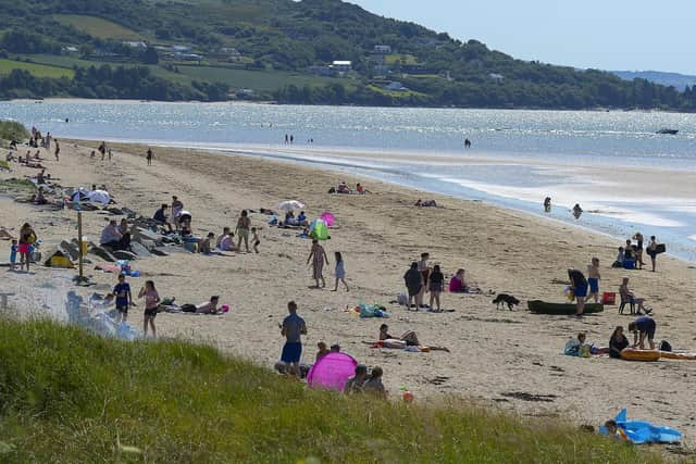

It's predicted temperatures in Derry and Donegal will rise from the 15-19 degrees range on Friday/Saturday to the 27-28 degrees range on Monday/Tuesday.
Met Éireann have issued a high temperature warning for the whole country from Sunday to Tuesday.

It states: "On Sunday, Monday and Tuesday exceptionally warm weather will occur over Ireland with daytime temperatures of 25 to 30 degrees generally and possibly up to 32 degrees in places on Monday. Night time temperatures will range from 15 to 20 degrees.
Advertisement
Hide AdAdvertisement
Hide Ad"Impacts: • Heat stress, especially for the more vulnerable of the population • High Solar UV index • Risk of water related incidents."
Meteorologists believe the highest temperature every recorded in Ireland - 33.3°C at Kilkenny Castle on June 26, 1887 - might be exceeded over the next few days.
The 8 hottest Junes on record globally all occurred in the last 8 years.
Keith Lambkin, Head of Met Éireann’s ‘Climate Services Division’ said: “Due to climate change, we are expecting to see heatwaves become longer, more frequent and intense than in the past. This increase in heat, increases the odds of temperature records being broken.”
Advertisement
Hide AdAdvertisement
Hide AdIn Britain the Met Office has issued amber and red heat warnings for Wales and England where temperatures are expected to rise to the 40s in some areas.
Met Office Chief Meteorologist Paul Gundersen, said “Exceptional, perhaps record-breaking temperatures are likely early next week, quite widely across the red warning area on Monday, and focussed a little more east and north on Tuesday. Currently there is a 50% chance we could see temperatures top 40°C and 80% we will see a new maximum temperature reached.
“Nights are also likely to be exceptionally warm, especially in urban areas. This is likely to lead to widespread impacts on people and infrastructure. Therefore, it is important people plan for the heat and consider changing their routines. This level of heat can have adverse health effects.”
This is the first time the Met Office has forecast 40 degrees in the UK. The current record high temperature in the UK is 38.7 degrees, which was reached at Cambridge Botanic Garden on July 25 in 2019.
Comment Guidelines
National World encourages reader discussion on our stories. User feedback, insights and back-and-forth exchanges add a rich layer of context to reporting. Please review our Community Guidelines before commenting.