
Ex-Hurricane Erin to influence Derry and Donegal weather this week with rain and blustery wind expected
Showers, sunny spells and some blustery winds are forecast for Derry and Donegal this week as the remnants of ex-Hurricane Erin track over Ireland from Tuesday.
The former Category 5 has now been downgraded but it is expected to have some influence on the weather in the North West as its tail passes between Ireland and Iceland over the coming days.
Both Met Éireann and the Met Office are forecasting more unsettled weather as an area of low pressure association with Erin becomes dominant this week.
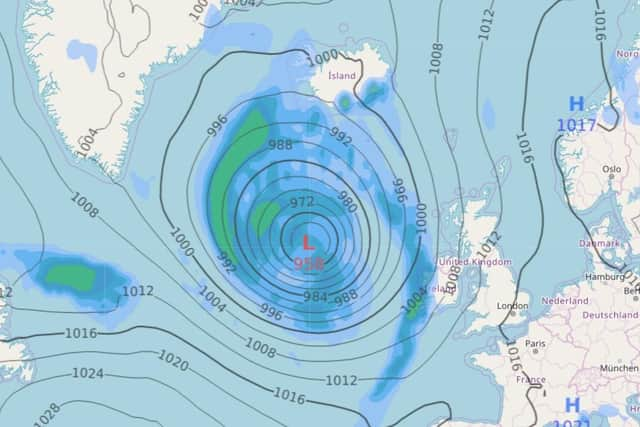
And Atlantic charts are currently forecasting a succession of lows over Ireland between now and September 4.
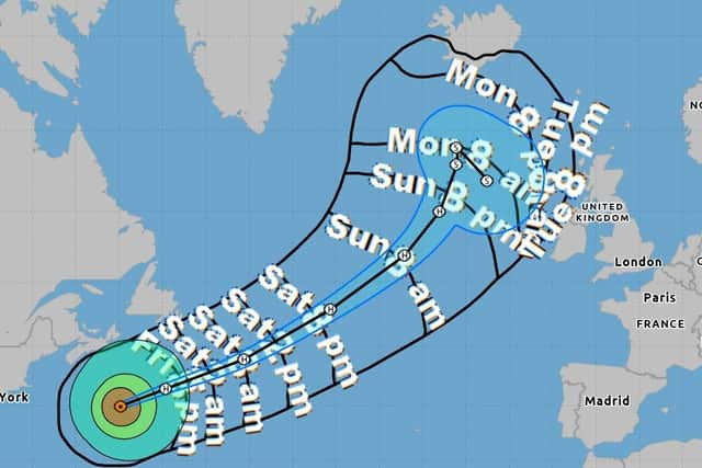

Met Office Deputy Chief Meteorologist Tony Wisson said: “Tuesday is when we’re likely to see the start of this influence, with a band of rain pushing from west to east over the UK. Rainfall could be heavy for a time in parts of the west, though it’s too early to be precise with details on this.”
Met Éireann predicts scattered showers will drift over the North West on Tuesday with fresh and blustery southwesterly winds from early morning. There will be sunny spells during the afternoon but more cloud will develop later in the evening with highest temperatures of 15 to 17 degrees
Tuesday night will be ‘wet and very blustery with strong and gusty southwesterly winds and widespread showers’ but these will gradually become ‘more isolated later in the night as winds ease too’. Lowest temperatures of 10 to 13 degrees are predicted.
The Met Office forecast for Derry for Tuesday is for a bright day with sunny spells and occasional showers.
These are most likely in the afternoon and probably most widespread in the west with a maximum temperature of 19 degrees.
The outlook for Wednesday to Friday, according to the Met Office, is for ‘a mixture of bright spells and showers’ with ‘the showers perhaps merging into a longer spell of heavy rain on Wednesday morning’.
This chimes with Met Éireann’s forecast for Wednesday which is for ‘a rather unsettled day with sunny spells and scattered showers, some of which would be heavy in the south and west for a time in the morning and afternoon’.
"Southwesterly winds will be strong at times along Atlantic coastal counties but gradually ease further east across the country. Some isolated sunny spells in the east with highest temperatures of 16 to 19 degrees,” suggests the Irish meteorology service.
The pattern continues later in the week.
On Thursday ‘low pressure is likely to remain in charge so the unsettled weather will continue with blustery westerly winds ushering a few showers, which could be heavy at times particularly in the west’.
It will be ‘a little cooler too with highest temperatures of 15 to 18 degrees’, says Met Éireann.
And on Friday ‘current models would indicate that low pressure will stay leaving another very unsettled day with showers and blustery winds for the western half of the country with slightly improved conditions further east.”
Met Éireann has issued a marine weather warning for small craft from Hook Head to west and north around the Irish coast as far at Malin Head.
The warning was issued for between 10pm on Monday until 4pm on Tuesday due to south to southwest winds that will reach force 6 at times.