

Since 1987 the Queen's University at Belfast has been developing the ‘Northern Ireland Place-Name Project’ and compiling an incredible database of names that sometimes date back over a thousand years.
In compiling the Derry city section the compendium draws heavily on John Bryson's seminal 'Derry's Streets'. Other sources, including George Vaughan Sampson's map of Co. Derry of 1814, are also cited.
Some of the meanings suggested in the database are open to interpretation and debate but make for fascinating reading.
Based in Queen’s University, the project works in collaboration with Land and Property Services in the Department of Finance in providing a free online database of our local place-names (www.placenamesni.org. This is accompanied by an interactive searchable map of historical names (townlands, parishes, baronies and counties) which is provided by LPS.
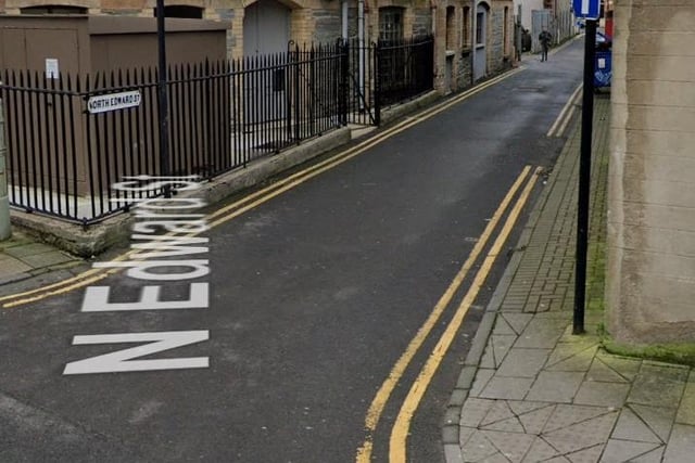
1. North Edward Street (Sráid Edward Thuaidh). Like Edward Street, named after Edward Toy(e), landlord. It was built in 1845, but only received a separate name from Edward Street in 1879
North Edward Street (Sráid Edward Thuaidh). Like Edward Street, named after Edward Toy(e), landlord. It was built in 1845, but only received a separate name from Edward Street in 1879 Photo: Google streetview
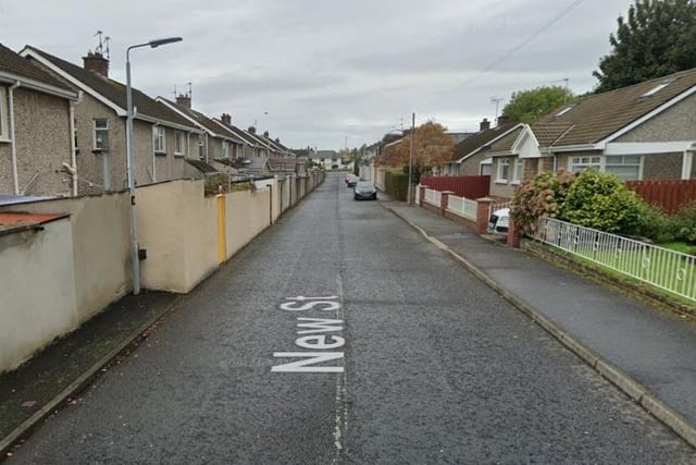
2. New Street (An tSráid Nua). Popularly known as Jampot Row (Bryson)
New Street (An tSráid Nua). Popularly known as Jampot Row (Bryson) Photo: Google streetview
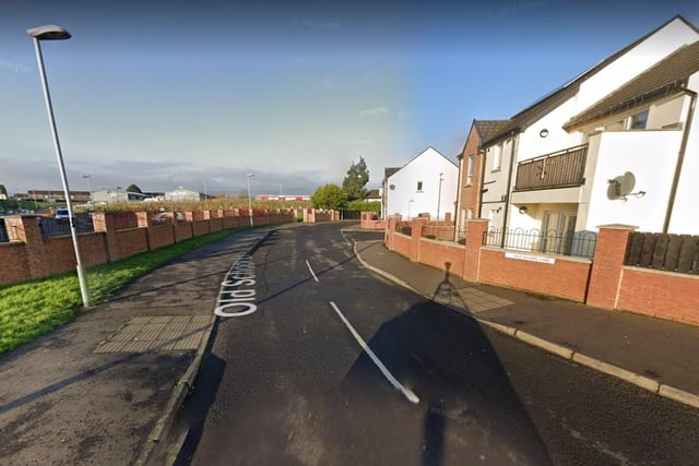
3. Old School Lane (Lána na Seanscoile). Named from former Shantallow National School (Bryson)
Old School Lane (Lána na Seanscoile). Named from former Shantallow National School (Bryson) Photo: Google streetview
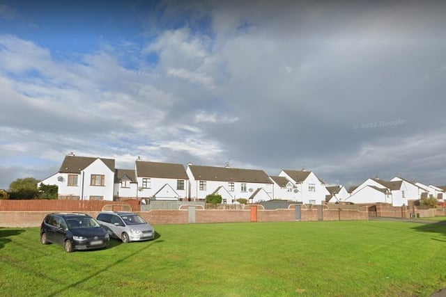
4. Old Mill Court (Cúirt an tSeanmhuilinn). Named from Pennyburn Mill, a corn mill with both a windmill and a waterwheel which was part of Pennyburn Distillery.
Old Mill Court (Cúirt an tSeanmhuilinn). Named from Pennyburn Mill, a corn mill with both a windmill and a waterwheel which was part of Pennyburn Distillery. Photo: Google streetview